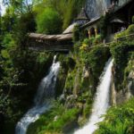
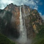
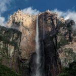
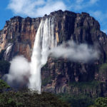
This 460’+ tall wall now has eight waterfall spouts, feeding the tributaries which become all Inisfreean canals.
–
Table of Contents:
- Purpose
- Crown of the Slope
- As Above, Not Below
- Special Features
- Location & Layout (Images Begin)
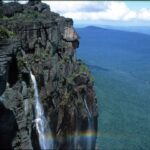
- Cliffs & Their Concepts
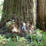
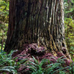
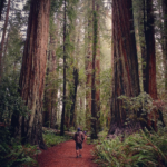
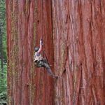
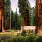
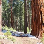
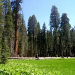
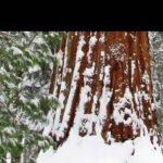
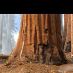
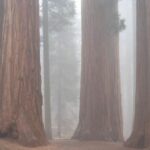
- Giant Trees
- WoW and Other Concepts
- Concepts for Archways to/from the Summit
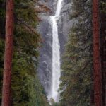
- Waterfalls Concepts
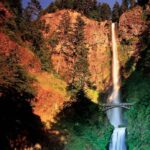
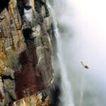
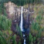
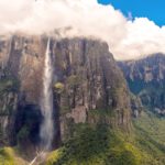
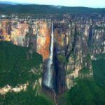
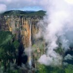
- All Angel Falls: How the Canals in Inisfree Start
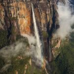
- Source: At the Top
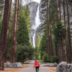
- More Views: Trails
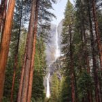
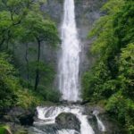
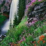
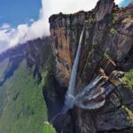
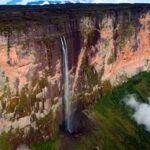
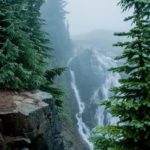
- Waterfalls: Downstream from Their Crests
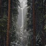
- Looking Up at Night
- 2022 Update: Scale-model in Minecraft
- 2024 September 14 Saturday/+
–
Purpose:
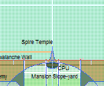
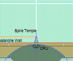
This construct is the titanic ‘halo’ of Inisfree’s main mountain. Encircling near/around the mountain’s summit, and with clusters of pinnacles hidden amidst the towering Redwoods and Sequoias around this ring, the Avalanche Ring Wall is the uniform precipice that regulates all water runoff from the Snow Dunes crown of the mountain.
The top rim of this structure is kept heated just enough to prevent any snow or ice buildup (that might otherwise fall over the edge, causing an avalanche), thus feeding the troughs to the eight waterfall-spouts.
–
Dimensions:
Wall:
- ~462′ tall (above local ground-level; where the slope meets the base of the summit’s plateau –thus taller overall, as part of it is anchored to the Grid Mind tentacles-mesh underground)
- ~33,175.22′ (~6.28 miles) “long”/around; circumference
- ~66′ thick
Highway Ports/arches:
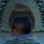
- ~330′ wide (a bit > than a football field, and almost identical to a rugby field’s length)
- ~165′ tall (~16 stories)
- ~330′ deep (front to back of the covered area; in/under the arch)
- no slope (flat/horizontal) at the base just outside the Avalanche Wall
- ~33° slope up through the Avalanche Wall; between that flat outer portion and the flat portion/section/s at/on
- the summit on the other side (encircled by the Avalanche Wall)
Spouts:
- ~450′ up the wall
- ~10′ diameter
- ~66′ back/channel/curve/trough
- ~455′ waterfall; top of the water in the trough/channel, to where the Avalanche Wall meets the ground at the top of the slope outside its circumference
- ~10′ at the top, the waterfalls from this wall expand to ~20′ where they meet the ground
–
Crown of the Slope:
The generally conical main mountain of Inisfree is a radial, usually-gradual slope, with the exception of the cliff-dweller neighborhoods, and the much lower and snaking ridge-lines nearer the Perimeter Wall. The Avalanche Ring Wall is the tier of Inisfree’s main mountain which signals the upcoming slope gradient change several more stories above it. Only beneath the altitude of the Avalanche Ring Wall can the wide variety of Inisfreean waterfalls be found.
–
As Above, Not Below:
Vegetation (very sparse, and not giant trees) extends somewhat up above the Avalanche Ring Wall, but the waterfalls do not. To enjoy your waterfall-showers, find them arching out from the Halo-esque (meaning: of the scale and color-scheme you would expect to find Forerunner ruins in the Halo video games) spigots atop the high edge of this sheer construct.
Also only located below this lengthy wall are the slope-situated restaurants, gyms, and glamping sites, placed there to catch the slightly warmer, flower-scented mountain breezes rushing up from the base to enter and fill the windows and doors of these establishments, contributing to a far greater and more breath-taking (and -restoring) meal and workout experience.
–
Special Features:
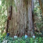
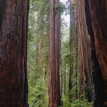
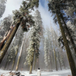
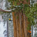
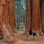
The highest of Inisfree’s forests surrounds the outer base of this vertical tube-like structure, and includes some of the tallest trees; Redwoods and Sequoias, with the only taller ones being in the triple-canopy rainforest, Ferngully Crater.
This is one of the main areas in Inisfree where pine nuts are harvested.
* Weddings to the Governor of the Inisfreean realm start here with a wing-suit B.A.S.E.-jump down to the main beach. Details here.
…
2023 August: If ever there was a hover issue (something threatening to bring Cloud City II falling down), repulsor beams (the opposite of tractor beams) would automatically turn on from beneath Cloud City II, as well as from atop the Avalanche Wall beneath it, while tractor beams auto’ turned on from the far side of the Avalanche Wall, helping prevent Cloud City II from tipping, while ICVs portal-ed or flew everyone out of Cloud City II.
As a last resort, CPs and WSs can be deployed within seconds to similarly assist, a WS even becoming a shelf-like platform to lower Cloud City II if necessary.
If the Cloud City II repulsines for some reason could not be brought back online after it was stabilized/caught by those other devices/structures/vessels, the best place for keeping that mile-diameter hemisphere-like megastructure inside our city / sky-dome is atop the wall along the desert plateaus; that part of our realm is the flattest, widest, sturdiest, and most-unused (almost never visited), etc..
These procedures were rehearsed in Autumn of 2023, everyone given weeks of noticed by our MAS plus from individual ICVs near them in the days leading up to the rehearsal/s.
The invincible ICs were, of course, not even dented or damaged at all during these drills.
In short, we have practically infinite tugboat-equivalent personnel/forces/vessels and supporting devices which are always ready to assist at a moment’s notice, and they have far more strength and precision than is needed to perfectly resolve/fix such a situation, and that situation isn’t even possible anymore, thanks to our perfected technology.
…
2024 June 14 Friday:
- Sound-based devices and backup-lasers prevent big chunks of snow or ice from flowing over/out and crashing down into the tributaries/trails below.
- ‘Smart’-forcefields and patrolling ICVs ensure no non-ICVs get close enough to slip/fall into the flow from the source/top of the spigots/waterfalls.
- These waterfalls are not that voluminous; the canals they start get much more water from what feeds into them through trickles and off-map creeks/streams all over our central mountain and beyond.
- The water fed through those spigots is mostly pumped back up to the summit/top; only a small portion of it is snow and ice-melt from up there.
–
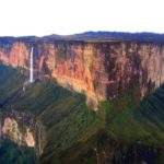
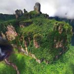
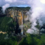
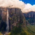
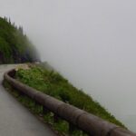
Location & Layout:


–
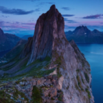
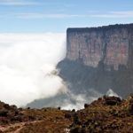
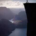
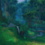
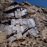
Cliffs & Their Concepts:


–
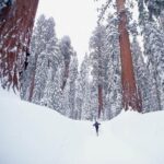
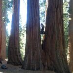
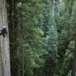
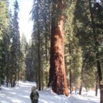
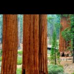
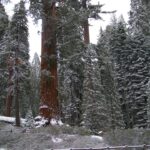
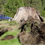
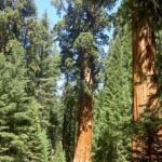
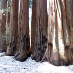
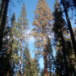
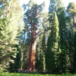
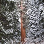
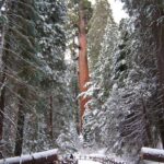
Giant Trees:


–
WoW & Other Concepts:


–
Concepts for Archways to/from the Summit:


–
Waterfalls Concepts:

–
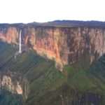
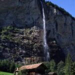
All Angel Falls: How the Canals in Inisfree Start


–
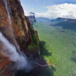
Source: At the Top


–
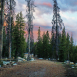
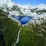
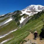
More Views: Trails


–
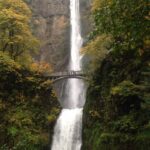
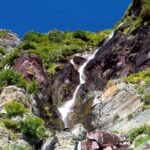
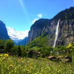
Waterfalls: Downstream from Their Crests
–
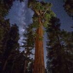
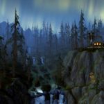
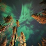
Looking Up at Night:


–
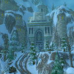
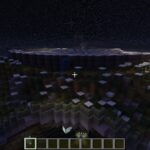
2022 Update: Scale-model in Minecraft


–
2024 September 14 Saturday/+:

This ‘crown’ of our central mountain reminds us that the greatest kings and queens are the landforms (demigods) and worlds (gods) themselves –thankfully incarnate in humanoid forms whenever I (Auz) call for them.
–
Also see:
- clear small waterfall, going under surface
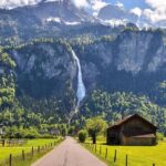
- Switzerland waterfalls Instagram clips
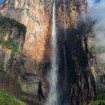
- Ribbon Falls, Yosemite national park; North America’s tallest single-drop waterfall (1,612′ in the Spring, thus ~3.6x taller than the waterfalls of our Avalanche Wall)
- sunrays
–