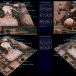
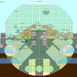
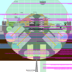
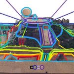
These maps show all the buildings, landmarks, and major roadways of our city. Included are sketches, cross-sections, clay models, and computer models.
–
Table of Contents:
- Early Sketches
- Clay Model
- Accurate Maps
- Cross-Sections
- Temperature Ranges
- Sunlight and Shadow
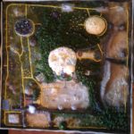
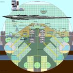
- Computer Model in Second Life
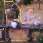
- Computer Model in Minecraft
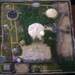
- Maps in Minecraft
- Comparisons
- 2022 Reveal: Inisfree’s Location on the Map
–
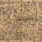
Early Sketches:
–
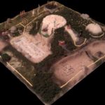
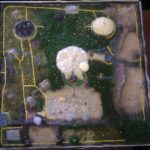
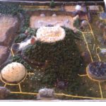
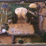
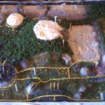
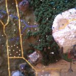
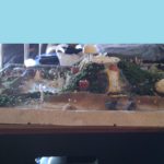
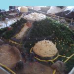
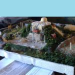
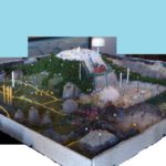
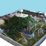
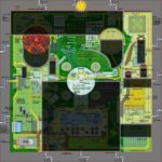
Clay Model:


–
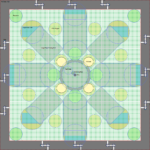
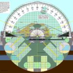
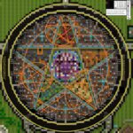
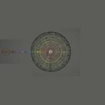
Accurate Maps:


–
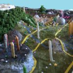
Cross-Sections:


–
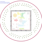
Temperature Ranges:


–
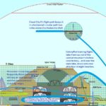
Sunlight and Shadow:


Cloud City II‘s altitude, paired with how high the Sun gets over the Antarctic horizon, means it never casts a shadow on any structure in Inisfree.
The Cloud City II-s in SSA, in Inisfree-like cities nearer their world’s equator, could cast a shadow at certain times, but their underside usually being lit, and their upper hemisphere being a see-through dome, results in a negligible shadow, even though each of those hovering structures are a mile wide.
–
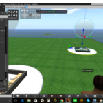
Computer Model in Second Life:

–
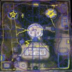
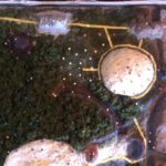
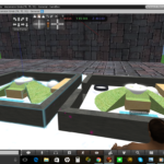
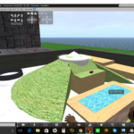
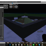
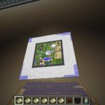
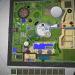
Computer Model in Minecraft:
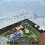


A MC-model block represents 146’×146′ (not 3’x3′ like in normal full-scale MC builds), and a grown non-giant tree takes up ~10’×10′ IRL, so each block-top with a potted sapling on it represents at least 14×14 grown non-giant trees; picture 196 such trees atop each MC block in this scale-model.
Midsized trees in our realm have cabins between their trunks, and wraparound multistory treehouses, each block-top in their region (of this scale-model) representing ~25 such trees; a 5×5 of those trees (and just 1 per 25 there being used as a treehouse base).
Up around the aval’ wall, the trees are larger (wider and taller); they are predominantly grown redwoods/sequoias, each taking up more like ~50’×50′, so each block-top there represents ~9 of them.
–
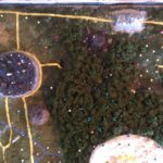
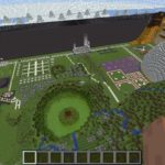
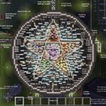
Maps in Minecraft:


–
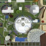
Comparisons:

–
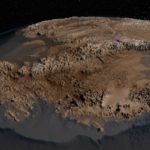
2022 Reveal: Inisfree’s Location on the Map
Classified for more than a decade until it was certain our city and empire were stable enough to defend themselves from anything, these maps show one of the studies that was conducted to pinpoint the best possible spot on Earth to build this special home of ours.
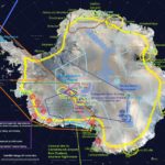

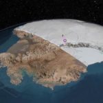
Inisfree is situated around this mountain such that High King Auz‘s private estate‘s lake-side faces the South Polar Hole (though it is not visible from that estate, being so many miles away and over the Antarctic horizon), with Dome Argus on the other side of that state-sized opening, and the Valkyrie Dome beyond it (both being ice-plateau regions, not normal-shaped recognizable domes). This is symbolic of how he always keeps an eye on this sacred opening to the hollow inner Earth where many of the gods and goddesses live in peace and prosperity; they have asked him to help protect it for them, which he does. Even when he is at rest in his private home, his views often look straight there.
Pearly Gate 1 faces Terra Adélie (the wedge-shaped section of this continent claimed by France for scientific research). This makes the only gate Inisfree ever allowed to be occasionally opened for pedestrian and vehicle traffic before it began relocating, while Inisfree was anchored on this location, closest to the largest Antarctic research station of the humans; town-sized McMurdo (~450 miles away; ~the distance across Oklahoma). The opposite side/gate of Inisfree somewhat faces the direction of the much closer research station, Amundsen-Scott (~400 miles away; ~the distance across Kansas).
This means that when you are inside Inisfree’s perimeter, if you are high enough up on its central mountain (thus able to see the Antarctic terrain out over the top of the city’s square perimeter wall), you will see the gleaming icy central landscape of Antarctica fanning out in all directions as far as the eye can see… except for when you face the Highway Cathedral‘s side of the perimeter wall; that way, you will see some of the dark mountains of the Trans-Antarctic Range (TAM). This is symbolic of how even the land and Earth itself are powerfully backing Inisfree and Auz. It is also nice for the residents on the quarter of the central mountain’s slope where the most and most-spacious residences are; the people in Inisfree living in its cabins, ryokans, and treehouses all can see those amazing signature landforms out there (which those in the castles, mansions, and palaces are farther down the slope, not having those mountains in their line of sight, though it is a short hike, drive, or flight up high enough to see them).
The shortest sub-glacial river-tunnel to Inisfree is the one which starts under the Ross Ice Shelf. One must take a submarine ~500 miles (~the distance from Los Angeles to Oregon) along the underside of that ice shelf, followed by ~250 miles (~the distance from New York City to Canada) through that river tunnel (~the width of Texas; 750/+ miles) which is more than a mile beneath the surface terrain/ice. Like many sections of the Amazon River, the rivers underneath Antarctica’s ice can be a few miles wide (the rock hard enough, and the ice thick enough above them, that they do not collapse, even with the slight warmth from the life living within these tunnels) –and deeper than the Amazon; there is definitely room for even the 2-miles-long rectangular-prism super-ships deployed from Inisfree via these tunnels to clean up the Earth in 2013.
Inisfree is ~1,500 miles (~the distance from the Canada–North Dakota border to the southernmost Texas-Mexico border) from Neuschwabenland‘s inner border, and ~2,000 miles (~the distance from Los Angeles to Detroit) from Base 211 (New Berlin). One of the sub-glacial tunnels Base 211 found and pioneered eventually stretches/connects to the underside of Inisfree; there is a river route all the way between these two amazing city-state communities. The route is expectedly very winding and complex, sometimes taking months at non-warp speeds to complete; it is not for the inexperienced or faint-of-heart to attempt, though it is exceptionally otherworldly, its beauty bordering on ‘magical’.
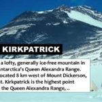
More than a mile above sea-level, Inisfree’s ground-level is high enough up that even if all the ice on Earth melted, raising global sea levels hundreds of feet, flooding all coastlines and submerging all current human coastal cities and towns, Inisfree’s borders would remain nowhere close to those risen waters. When Inisfree leaves this spot, however, it will leave an inverted dome-shaped bowl-like crater/’footprint’ extending down to five miles below sea-level at its center point, taking all of Mt. Kirkpatrick with it, having assimilated that mountain into its structure back in 2011-2012. Where it used to be… will eventually fill in with water, forming the deepest lake on Earth –only 1.85625 miles less deep than the Mariana Trench (and the 8 miles-wide sub-glacial river-tunnel ‘mouths’, that once connected to the outsides of its giant underground gates, now exposed, the ice-melt within them then pouring out and down into that ‘bowl’… until it is, at least to their level, filled).
Even with all these details, it is not possible to “find” or accidentally reach Inisfree; to everyone who has not been approved by Auz to go there, even if they get within a few miles of its perimeter wall, well-within its Perimeter Orb, they would see only a continuation of the gleaming ice and snow, and blizzard-like whiteout conditions in the sky, the technology of the Sentry Towers (which would appear like snowy icy mounds/hills to passersby) ensuring no unauthorized outsiders ever made it to the city’s wall’s outer surface, or even to the concentric defensive rings which are between it and the Sentry Towers). No one has ever been able to get close enough to Inisfree to see these outermost features of it… without being invited by Auz. No one uninvited ever will; it just isn’t possible, all other beings in Creation being far less aware and advanced.
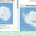
What about the humans who have claimed going to Mt. Kirkpatrick since 2010 when Auz and his first team arrived there to start forming Inisfree? Perhaps they were mislead to think they were on that mountain, when they were actually someplace else. Perhaps some of them were also part of a clever misinformation/misdirection campaign to contribute to the preservation of the secrecy of this pristine realm.
The real Mt. Kirkpatrick has, since 2010, and shall forevermore be, part of Inisfree, thus the property of High King Auz. No one has reached that mountain since that first year of Inisfree’s formation, other than those he has personally approved. Only those who are fully compatible with him ever get/got to return.
To this day, no anomalies or irregularities show up on any maps of this area, regardless of the sophistication of the equipment –even satellites– used to make any given maps. This is the result of vast teams of supercomputer-brained beings working brilliantly together to ensure it never even appears to experts that something out here was deleted or blurred out –or Photoshopped in (and they can do this by figuring out all the ‘telltale’ signs expert humans would look for and notice, then adjusting the data in those humans’ systems and records in ways which they would not notice or even look for). To everyone who trains their eyes, electronic/satellite or otherwise, on this location, it looks like the rest of the Antarctic terrain or the TAM.
–